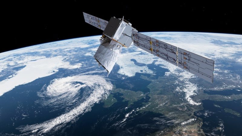
The measurement of winds is an essential element of our daily lives. Whether it’s predicting the weather, determining where to place wind farms, constructing airports, or knowing when to evacuate populations during cyclones, understanding winds and having a monitoring system for them is crucial. It is for this purpose that Aeolus was created, the first satellite designed to measure winds from space. To achieve this, Aeolus is equipped with an instrument called Aladin, which is essentially a LIDAR coupled with measurements of the Doppler effect and various other optical phenomena that will be detailed in the following paragraphs.
History
This satellite, named after the Greek god Aeolus, the god of winds who notably aided Odysseus on his journey home from Troy, is part of the European Space Agency’s (ESA) Living Planet Program. This program encompasses all space missions dedicated to Earth observation. The Sentinel constellation, which we have already discussed during the launch of Sentinel 3B, is part of this program, but Aeolus belongs to the Earth Explorer group. This group comprises satellites aimed at scientific research, as opposed to the Sentinels, which continuously collect data on our beautiful blue (and green) planet.
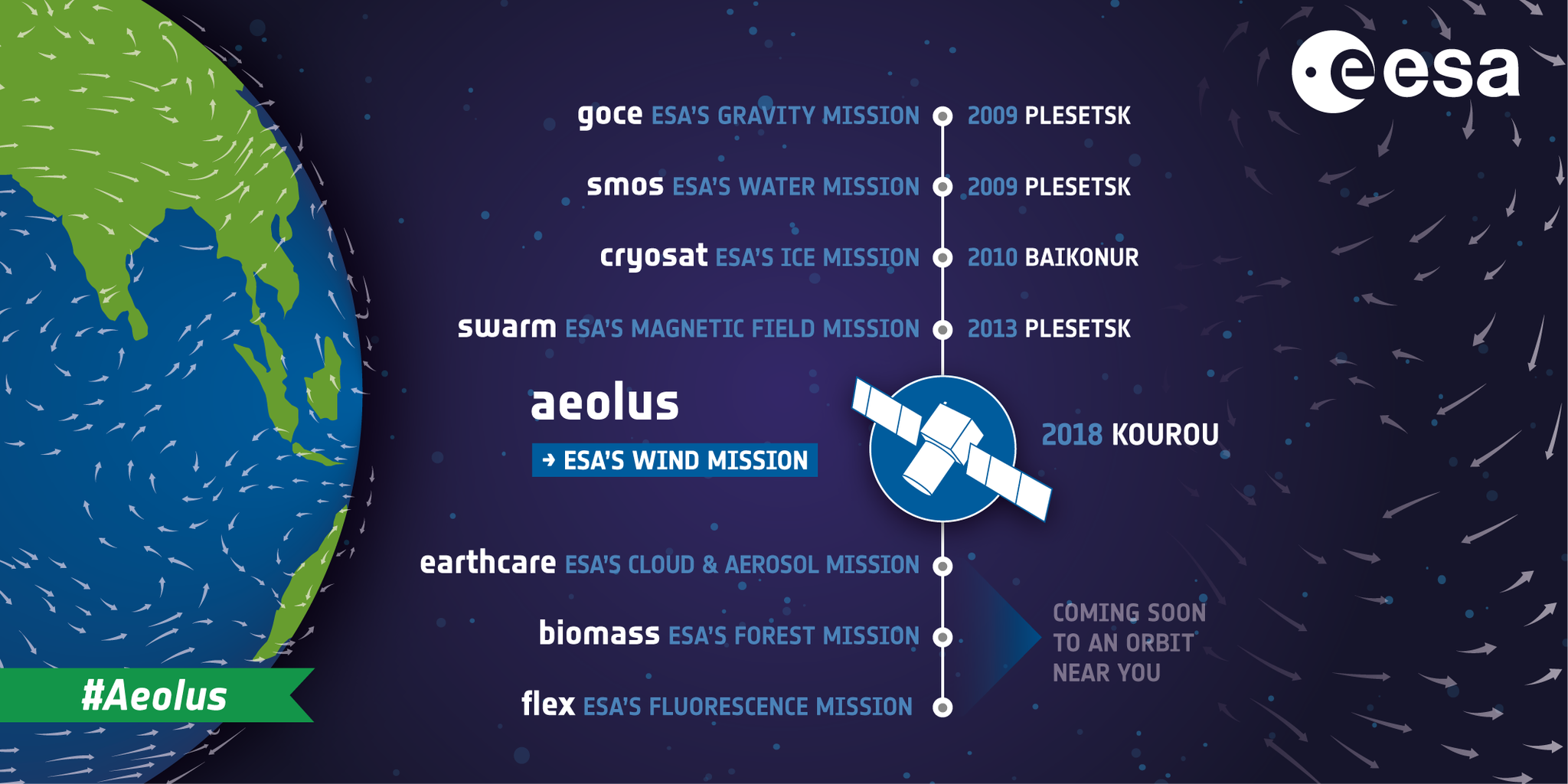
There are currently eight Earth Explorer missions:
- GOCE, launched in March 2009, measured the Earth’s gravitational field with very high precision to create a global map.
- SMOS, launched in November 2009, studied the terrestrial water cycle by measuring ocean salinity and soil moisture.
- CryoSat 2, launched in April 2010 after the failure of CryoSat 1 in 2005, measures fluctuations in ice thickness on land and in oceans.
- Swarm, launched in November 2013, has provided the best model of the Earth’s magnetic field and its evolution over time.
- ADM-Aeolus, launched in August 2018, will demonstrate the ability to characterize winds using lasers.
- EarthCARE, scheduled for launch in 2018, will improve our understanding of how the Earth reflects, absorbs, and retains radiation.
- Biomass, planned for launch in 2020, will provide measurements of biomass and carbon stored in forests, enhancing our understanding of the carbon cycle.
- FLEX, scheduled for launch in 2022, will map plant fluorescence to quantify photosynthetic activity.
The ADM-Aeolus (Atmospheric Dynamics Mission Aeolus) project was initiated on the eve of the year 2000 and was selected by ESA to kickstart the Living Planet program. Originally slated for launch in 2007, delays due to issues in the design and manufacturing of the satellite’s main instrument pushed the ultimate launch date to August 2018. In 2003, the EADS Astrium Satellites group, later known as Airbus, was chosen to develop Aeolus. In 2000, an initial satellite concept was envisioned. It was intended to weigh 785kg, feature a 1.10m telescope, and be powered by 725W solar panels. However, considering its low orbit and the significant atmospheric drag, as well as the large number of photons scattered by the atmosphere, the design was modified. The fuel quantity was doubled, the telescope size increased to 1.50m in diameter, and the shape of the protective tube optimized. Ultimately, Aeolus’s mass was nearly doubled to a total of 1,400kg.
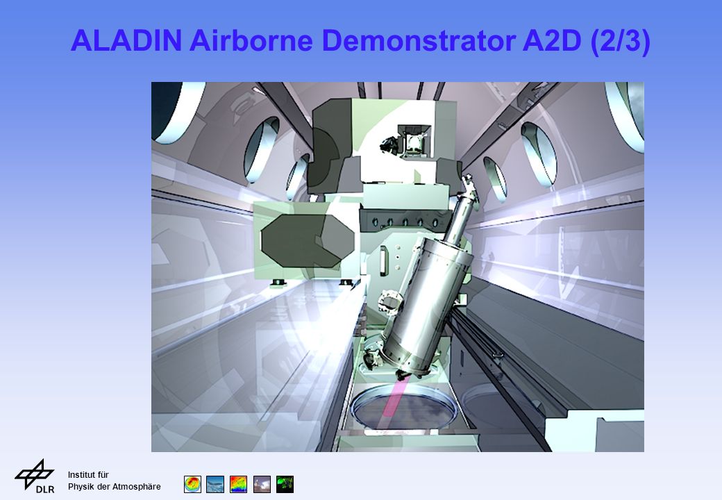
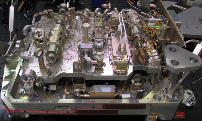
Then came the development of the Aladin instrument. It is based on a technology never before used in space, and because of this pioneering aspect, numerous problems arose. As a result, the mission was delayed by 10 years! One of the major obstacles was the defense secrecy surrounding ultraviolet lasers because they were used in atomic bombs. Once the issues were resolved (these solutions will be described later), a small prototype, A2D (ALADIN Airborne Demonstrator), was built and placed on an aircraft of the German space agency, DLR, for testing.
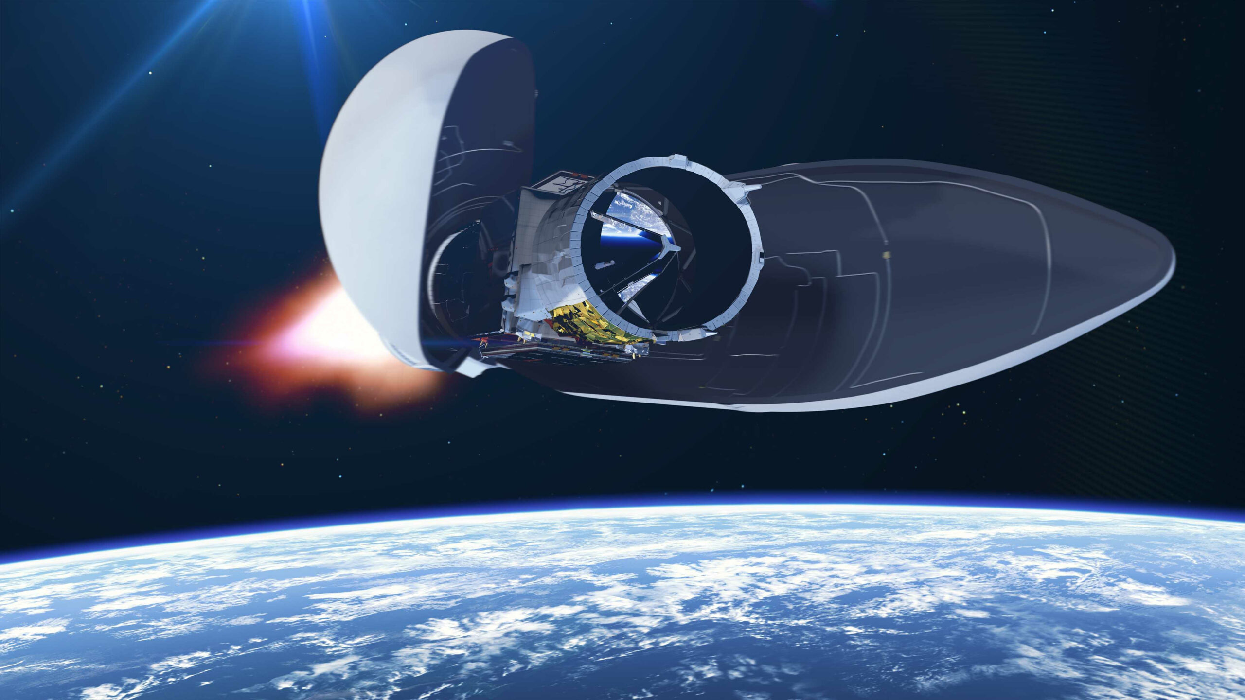
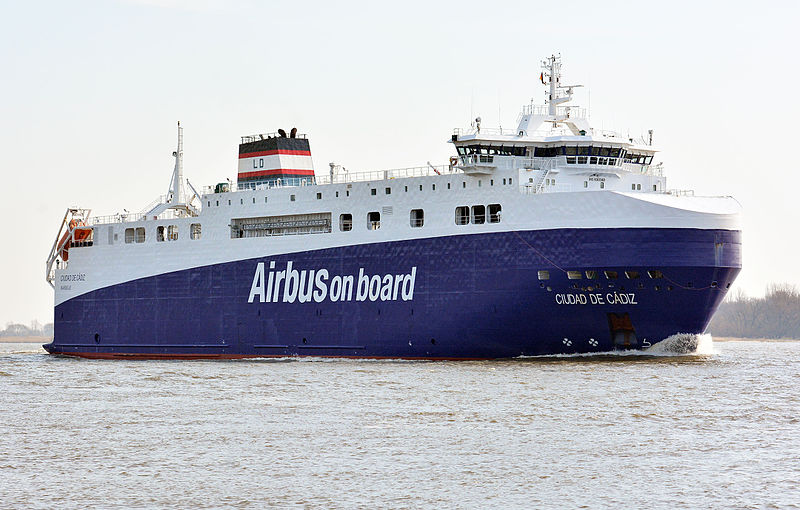
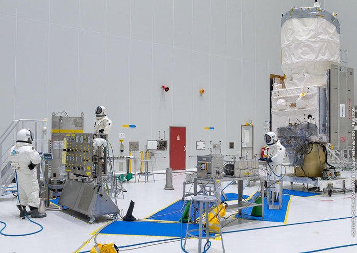
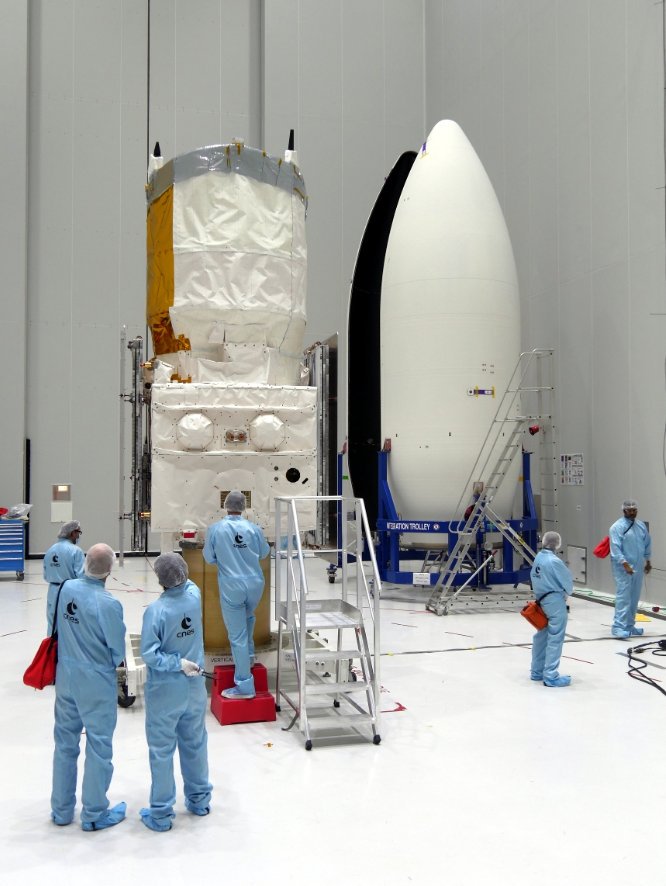
In the end, the project cost 550 million euros, which is relatively low compared to military projects. In 2016, the European lightweight launcher Vega was selected to orbit Aeolus, and the launch was scheduled for late 2017. In May 2017, the satellite arrived at the Space Centre of Liège in Belgium, a center specialized in space optics, to undergo a series of tests including 50 days of vacuum tests to qualify the Aladin instrument. Then, Aeolus was transported to Kourou, but instead of traveling by plane like most satellites, it crossed the Atlantic by boat. Why, you may ask? Due to the rapid depressurization during descent in altitude, Aeolus could have been damaged by the ingestion of pollutants and dust. Therefore, the Ciudad de Cadiz freighter carried it to French Guiana.
ALaDIn
The scientific instrument that Aeolus will use to carry out its mission is called Aladin, which stands for Atmospheric Laser Doppler Instrument, to which engineers added a touch of humor so as not to simply call it ALDI. It will use a powerful ultraviolet laser (355nm wavelength) for its measurements. Aladin will send very short pulses of this laser towards the Earth (100 pulses per second). When these pulses encounter dust or aerosols in the air, they will be reflected and potentially detected by Aeolus. By measuring the time between emission and reception, Aladin will be able to calculate the distance to these dust or aerosol particles.
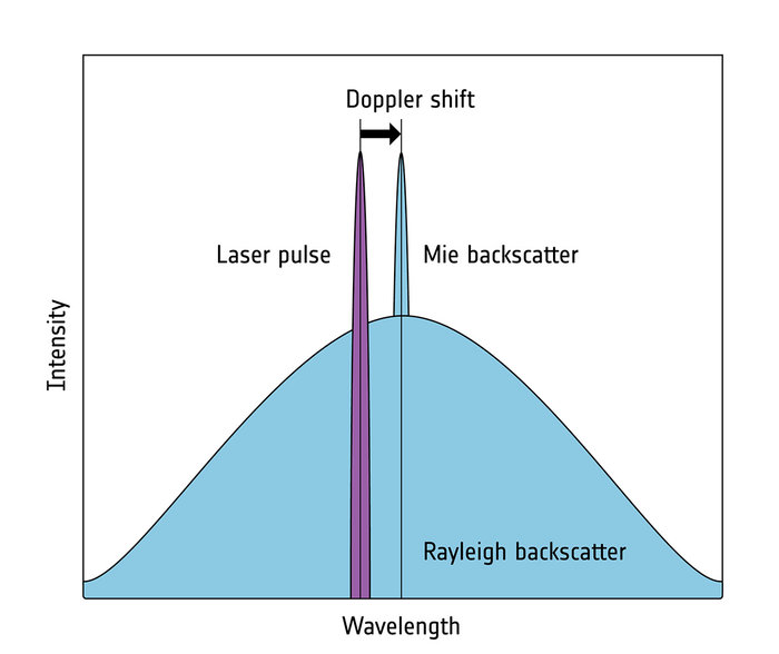
But how can we measure wind speed if we only have access to distance? This is where the “D” in Aladin comes into play! Thanks to the Doppler effect, when the light pulse encounters a particle in the air, if that particle is in motion, the wavelength of the pulse will be altered. It will either be increased if the particle is moving away from Aeolus, or decreased if it is moving towards it. Thus, by measuring the shift in wavelength between the pulse sent and the pulse received, it is possible to determine the speed of the particle’s movement. And since this particle is carried by the wind, we then have a measurement of the wind speed!
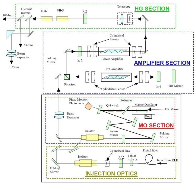
Aladin is composed of a laser that generates 5W of light with a wavelength of 355nm (outside the visible spectrum for humans). This wavelength was chosen because it is the most reflected by atmospheric molecules. To create this coherent beam, an arrangement of laser sources (Nd-YAG lasers that produce pulses with an energy of 120mJ at a frequency of 100Hz), lenses, amplifiers, etc., was set up. And we come back to one of the problems that caused so much delay! Due to the energy transported by this laser, the internal optics reach very high temperatures: 1,700°C. As a result, the surface of the various optical elements darkens in the absence of atmosphere. To remedy this issue, engineers had the good idea to continuously inject a small amount of oxygen, which, by oxidizing the contaminants produced on the surface of the optics, allows their removal. In order to meet the oxygen needs during the three-year mission, a 15kg reservoir was added to the satellite.
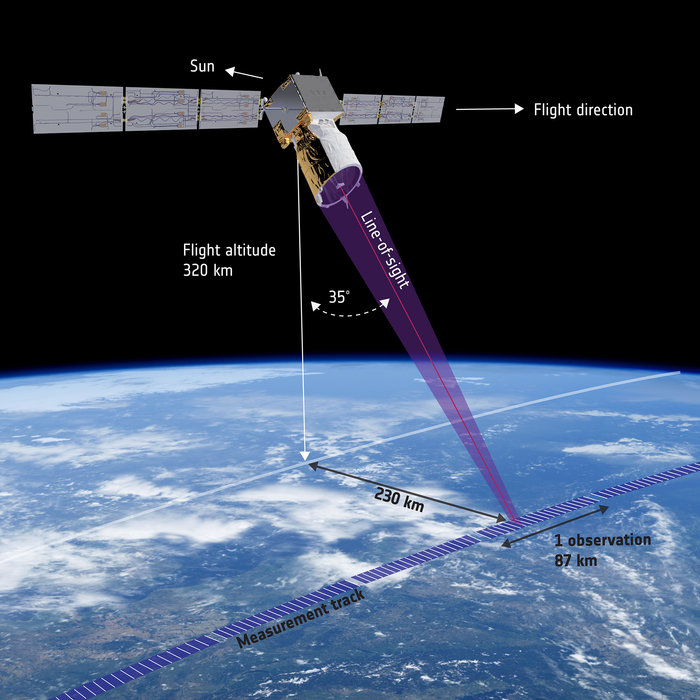
Once the coherent laser beam is generated, it is reflected onto a 1.50m diameter telescope to be directed towards Earth. This telescope is pointed at a 35° angle from the orbital plane to transmit and receive light perpendicular to Aeolus’s velocity. Thus, Aladin can measure the East-West component of wind speed. Once the laser is reflected by the particles in the air, it is captured by the same telescope and redirected towards two highly sensitive photodetectors that transform the light signal into an electrical signal, which is then analyzed to deduce the Doppler shift and various other information. Through these calculations, Aladin can measure wind speed with a precision of 1 to 2 m/s depending on altitude and within an atmospheric layer of 14 km (from 2 to 16 km). In total, Aeolus will perform 100 profile measurements per hour.
Technical Specifications
Aeolus measures 4.6m in height, 1.9m in width, and 2m in depth, with a total launch mass of 1,366kg: 650kg for the platform, 450kg for the payload, and 266kg of propellant for orbital maneuvers. It is equipped with two fixed solar panels providing power to the satellite. Together, they cover 13.4m² and generate an average of 1.4kW of power, with a peak of 2.4kW thanks to gallium arsenide cells. This electricity is stored in 84Ah Li-ion batteries to ensure continuous power supply even during nighttime. Once data is collected, Aeolus transmits it via X-band to the Norwegian ground station in Svalbard at a rate of 5 Mbits/s. With its 4 Gbit memory, the satellite can store data for up to 72 hours.
For a mission requiring such precision, attitude control is essential. That’s why Aeolus is well-equipped in this regard: it has a GPS receiver to determine its position with a resolution of over 10m, a precise star tracker at 13µrad, and an inertial reference unit using fiber optic gyroscopes providing the necessary information for proper satellite orientation. To correct its orientation, Aeolus is equipped with four reaction wheels as well as magnetotorquers for wheel desaturation. Four small rocket thrusters, each with a thrust of 5N and burning hydrazine, handle orbit corrections.
Launch
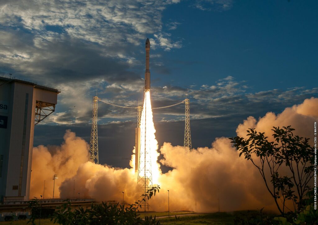
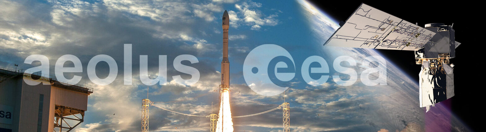
Aeolus was launched on August 12, 2018, at 11:20 p.m. CEST from the Guiana Space Centre in Kourou. It was the 12th Vega light rocket that was responsible for placing this satellite into a heliosynchronous orbit at an altitude of 320km. This orbit is inclined at 96.7° relative to the Earth’s rotation axis, so measurements will be taken every 250km at the latitude of Bordeaux. The satellite was successfully deployed after 54 minutes and 57 seconds. Once again, the small Italian launcher, which will soon be replaced by Vega-C, demonstrated its reliability.